Statewide Data and Modeling Program
Hydrologic and hydraulic models use software to simulate the flow of rainfall runoff and predict the rise of water levels and flooding.
The state is working with technical experts, federal partners, academic institutions and local stakeholders to create models of Louisiana’s watersheds. These models will simulate flood scenarios and analyze potential flood mitigation solutions. This effort will support regional collaboration around shared water management challenges and build an objective, science-based understanding of how projects, policies and other measures will reduce flood risk.
Guidance on Modeling Methodology
This document provides general guidance on LWI’s modeling methodology and approach. The state developed this guidance in collaboration with modeling consultants to ensure consistency among models, ensure model designs include proper attributes, inform scope development and set expectations regarding desired features and quality control.
Model Use, Storage and Maintenance Plan
While the models are in development, this plan provides the framework needed to support long-term management of watershed models statewide, with proposed recommendations for state, regional and local model use and storage.

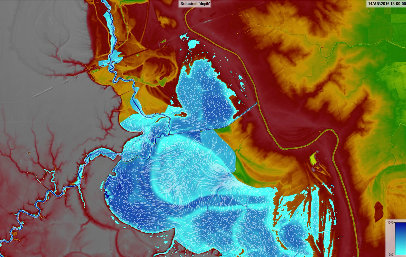
Click the map above to view an interactive map of the LWI gauge network design.
River and Rain Gauge Network
As part of the modeling program, the state is investing $15 million to install river and rain gauges at about 100 sites throughout Louisiana over the next six years, in partnership with USGS. LWI—in collaboration with the University of Louisiana at Lafayette, Tulane University, USGS, DEQ and NOAA—designed an enhanced gauge network based on input provided by local and regional stakeholders regarding areas where additional gauges are needed.
Once deployed, the network will provide enhanced statewide coverage for monitoring riverine and rainfall information in real time and support the development and use of watershed models. Local communities will have information to respond more effectively to flood-related hazards, while the state’s watershed regions can develop more effective mitigation strategies.
Stakeholder Input
The state collected feedback on proposed gauge locations from local and regional technical experts using regional interactive web apps. This input helped the state and its partners identify gaps in the network and design an enhanced system with new gauge locations.